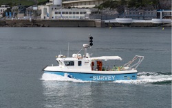
The International Hydrographic Organization (IHO) has released a new edition of the Standards for Hydrographic surveys (S-44). These standards relate to surveys that support the safety of navigation and can also be adapted for oil and gas, renewable energies, dredging, geophysics and geotechnics.
First published in 1968, the standards are regularly updated to keep pace with new technology and methods.
Among the changes in the latest version is the introduction of a new, more stringent classification for surveys called 'Exclusive Order' which expands the standards' applicability. This is designed for specific critical areas such as harbours and channels with minimum underkeel clearance and bottom characteristics which could be hazardous to vessels. In these areas, an increased accuracy of 10 cm on a map can help precisely determine requirements for dredging and avoid unnecessary costs, IHO said.
Another key feature of the new edition is the 'Specification Matrix', a matrix of parameters and data types defining the required accuracy depending on the hydrographic needs. The aim is to allow flexibility in the survey definition and to accommodate these various needs as well as emerging technologies such as satellite derived bathymetry.
Designed to be used by both institutional and commercial surveyors, S-44 (https://iho.int/uploads/user/pubs/standards/s-44/S-44_Edition_6.0.0_EN.pdf) specifies the minimum standards to be achieved depending on the intended use. Hydrographic offices and organizations may define more stringent or specific requirements for national or regional variations when necessary. For procedures for setting up equipment, conducting surveys and processing the resulting data, users can refer to the IHO Manual on Hydrography (Publication C-13) (https://iho.int/uploads/user/pubs/cb/c-13/C-13.pdf).
> Go to Oil, gas and energy industry homepage
> Go to Transport industry homepage


